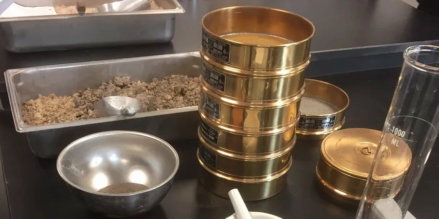
A commercial development on the Mountmellick Road hit unexpected silty layers at 2.8 m depth last winter—the contractor had assumed a well-graded gravel based on nearby boreholes. That assumption changed the foundation design entirely once we ran a full particle size distribution. In Portlaoise, where glacial tills and alluvial deposits mix unpredictably along the Triogue River corridor, relying on visual classification alone is a gamble. Our grain size analysis combines mechanical sieving for the coarse fraction and hydrometer sedimentation for fines passing the 63 µm sieve, giving you a complete curve from 75 mm down to 2 µm. We run this routinely under IS EN ISO 17892-4:2016, and the data feeds directly into drainage design, frost susceptibility checks, and compaction specs. For projects near the M7 interchange where imported granular fill is common, we often pair this test with an in-situ permeability assessment to verify drainage assumptions before placing stone columns or working platforms.
If you're only sieving to 63 µm and ignoring the hydrometer, you're blind to half the soil's behavior—especially in the glacial clays common across Laois.