GEOTECHNICAL ENGINEERING
PORTLAOISE
HomeInvestigationExploratory test pit

Exploratory Test Pit Investigations in Portlaoise

Practical geotechnics, field-tested.

LEARN MORE

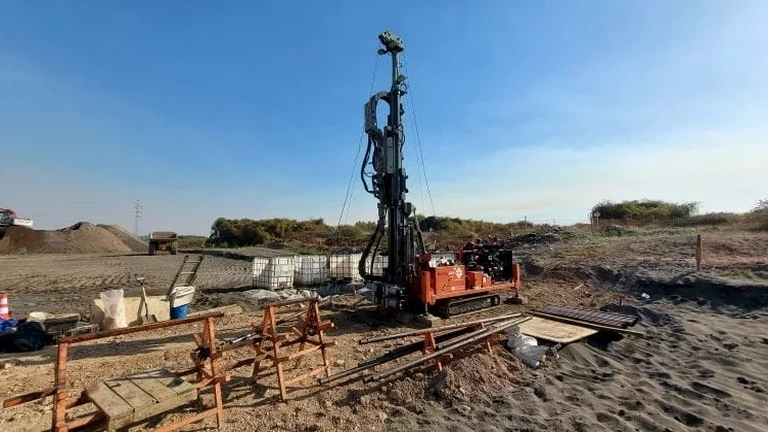
In Portlaoise, ground investigation governed by I.S. EN 1997-2:2007 is the starting point for any project where the boulder clay or limestone bedrock needs direct visual logging. An exploratory test pit in Portlaoise provides a physical window into the near-surface deposits, letting the geotechnical engineer measure bedding, record groundwater seepage at the rockhead interface, and collect undisturbed block samples. For the commercial developments expanding along the M7 corridor, skipping this step can miss a thin layer of soft alluvium that changes the bearing stratum entirely. We combine the test pit observations with supporting in-situ permeability testing when drainage design is critical, and the plate load test to verify bearing stiffness on the same excavated level, ensuring the foundation recommendation matches what the eye can actually see.

Seeing the contact between the boulder clay and the limestone bedrock in an open excavation removes the guesswork that borehole logs can sometimes leave behind.

Our service areas

How we work

On sites around the Timahoe Road or out toward the Rock of Dunamaise, we frequently see that the glacial till looks competent at the surface but masks a weathered zone just two metres down. An exploratory test pit in Portlaoise catches that transition before the excavator bucket reaches refusal on limestone. The trench is logged to I.S. EN ISO 14688-1:2018, with photographic records, pocket penetrometer readings, and sampling of cohesive layers for atterberg limits classification. Typical pit dimensions range from 2.5 m to 4.0 m depth, with benched sides where workers must enter for detailed fabric mapping. In Portlaoise, the local till often contains cobble-sized limestone clasts that influence trench stability; our team sizes the pit and schedules the backfill so the contractor loses no time. Each log sheet records moisture condition, consistency, colour, and any organic lenses that could cause long-term settlement.
Exploratory Test Pit Investigations in Portlaoise
Technical reference — Portlaoise

Local ground factors

Ground conditions vary noticeably between the historic town core near Fort Protector and the newer housing estates east of the Triogue River. In the town centre, made ground up to 2.5 m thick sits directly over boulder clay, often hiding old cellars or buried services that a trial hole is the only reliable way to locate before piling. East of the river, the till thins and sandy gravel lenses appear at shallow depth, creating a perched water table that softens the formation during winter months. An exploratory test pit in Portlaoise that is dug in June can look dry and stable, but the same stratum in February will show groundwater inflow that demands a redesign of the footing drainage. Without a visual record of that seasonal water level, the subfloor ventilation detail becomes a guess, and in Portlaoise the winter rainfall regularly proves those guesses wrong.

Need a geotechnical assessment?

Reply within 24h.

Email: contact@geotechnical-engineering.co

Regulatory framework

I.S. EN 1997-2:2007 – Ground investigation and testing, I.S. EN ISO 14688-1:2018 – Identification and classification of soil, I.S. EN ISO 22475-1:2006 – Sampling methods and groundwater measurements, Safety, Health and Welfare at Work (Construction) Regulations 2013 (S.I. No. 291/2013)

Technical data

ParameterTypical value
Maximum standard depth4.0 m (deeper with stepped benches)
Typical pit plan dimensions2.5 m x 1.2 m to 3.5 m x 1.8 m
Logging standardI.S. EN ISO 14688-1:2018
Sampling methodBlock samples, bulk disturbed samples, Shelby tubes from pit floor
Groundwater observationSeepage mapping and standpipe installation in pit base
Backfill specificationEngineered granular fill, compacted in lifts to 95% MDD
Health & SafetyConfined-space protocol, shoring or battering per Safety, Health and Welfare at Work (Construction) Regulations 2013

Common questions

How deep can an exploratory test pit go in Portlaoise's ground?

Most pits reach 3.5 to 4.0 metres before hitting the limestone bedrock that underlies much of Portlaoise. Where deeper inspection is needed, we bench the sides to maintain stability, though for depths beyond 4.5 metres a borehole investigation usually becomes more practical. The boulder clay here stands well in the short term, but we always assess the face before any entry.

What does a trial pit investigation cost for a single-house site in Portlaoise?

For a typical residential plot in Portlaoise, an exploratory test pit investigation including machine excavation, logging, sampling, and a factual report generally runs between €460 and €660. The final figure depends on access, the number of pits, and whether additional in-situ tests like permeability measurements are included.

How long after the pit is dug before you can pour foundations?

The pit itself can be logged and backfilled the same day. If we take samples for laboratory classification, the report is typically ready within 5 to 7 working days. The foundation design can proceed as soon as the factual report is issued, so there is minimal delay to the construction programme.

Do you need a trial pit if a Site Investigation report already has boreholes?

Boreholes give a vertical profile at discrete points, but an exploratory test pit in Portlaoise reveals lateral continuity of strata, the true character of the fill, and any buried obstructions that a borehole can easily miss. On sites with variable made ground, the test pit adds a level of confidence that borehole data alone cannot provide.

Location and service area

We serve projects in Portlaoise and surrounding areas.

View larger map