GEOTECHNICAL ENGINEERING
PORTLAOISE
HomeGeophysicsSeismic tomography (refraction/reflection)

Seismic Tomography (Refraction/Reflection) for Site Investigation in Portlaoise

Practical geotechnics, field-tested.

LEARN MORE

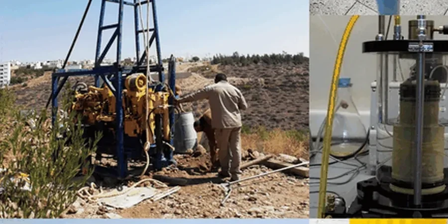
The limestone that underpins Portlaoise doesn't always tell the truth from the surface. We've pulled cores from sites near the Triogue River where competent rock appeared at 2 metres in one borehole and vanished into a clay-filled fissure 15 metres away. That's the midlands karst reality. Seismic tomography cuts through the guesswork. We run refraction surveys for shallow bedrock mapping and reflection lines when we need to image deeper horizons, applying the methodology laid out in I.S. EN 1997-2:2007. The data feeds directly into foundation design, reducing the likelihood of surprise overbreak during excavation. For projects on the glacial tills that mantle much of County Laois, combining tomography with CPT testing gives us a continuous profile where the till transitions to weathered limestone, a boundary that conventional drilling can miss between boreholes.

A single seismic refraction line can image what twenty boreholes might miss in karstic limestone.

Our service areas

How we work

The field setup we deploy around Portlaoise uses a 24-channel seismograph with 4.5 Hz geophones spaced at 2 to 5 metre intervals, depending on target depth. The energy source varies: a 10 kg sledgehammer on a steel plate works well for refraction profiles up to 30 metres depth in the compact tills; for reflection surveys aiming at 80 metres or more, we switch to a Buffalo gun or weight drop. Data processing runs through SeisImager and ReflexW, with first-arrival picking checked manually. What sets the midlands work apart is velocity contrast. Dry limestone can push 3,500 m/s while saturated, weathered zones drop below 1,600 m/s. That contrast makes karst features jump out on the tomogram. The method integrates naturally with MASW surveys when shear-wave velocity profiles are needed for seismic site classification under I.S. EN 1998-1:2005, a requirement for larger commercial structures in the town centre.
Seismic Tomography (Refraction/Reflection) for Site Investigation in Portlaoise
Technical reference — Portlaoise

Local ground factors

Portlaoise sits on Carboniferous limestone with a well-documented history of solution features. The Geological Survey of Ireland's karst database flags multiple recorded conduits and swallow holes within a 5 km radius of the town centre. A foundation designed on the assumption of continuous rock can encounter a dissolution cavity exactly where the highest column load lands. The cost of that discovery during piling is orders of magnitude higher than a pre-design seismic survey. Refraction tomography catches these features because the velocity field distorts around air- or clay-filled voids. Reflection profiles add depth penetration when the bedrock surface is irregular, which it often is under the glacial deposits that blanket the Portlaoise Ridge. We've mapped pinnacles and cutters that varied 6 metres in elevation across a single building footprint. Without the geophysical picture, the geotechnical model is just an interpolation between points. With it, the contractor prices the ground risk accurately.

Need a geotechnical assessment?

Reply within 24h.

Email: contact@geotechnical-engineering.co

Explanatory video

Regulatory framework

I.S. EN 1997-2:2007 — Geotechnical design — Ground investigation and testing, I.S. EN 1998-1:2005 — Design of structures for earthquake resistance (site classification), Geological Survey of Ireland — Karst Database and Bedrock Mapping Standards, ISRM Suggested Methods for Rock Characterization (velocity criteria), ASTM D5777-18 — Standard Guide for Seismic Refraction (referenced where no conflict with Eurocode)

Technical data

ParameterTypical value
Maximum refraction depth (sledgehammer source)25–35 m in competent ground
Maximum reflection depth (weight drop source)80–120 m depending on stratigraphy
Typical geophone array24 channels, 2–5 m spacing
Velocity range for limestone (intact)2,800–4,200 m/s
Velocity range for weathered/karstic zone1,200–2,200 m/s
Data format deliverablesSEG-2, SEG-Y, PDF tomograms, DXF
Applicable standardI.S. EN 1997-2:2007 + Eurocode 8
Typical survey duration (single line)3–6 hours field + 2 days processing

Common questions

How deep can seismic refraction see in Portlaoise ground conditions?

With a sledgehammer source on the compact glacial tills typical around Portlaoise, we reliably image to 25–30 metres depth. The limiting factor is usually the velocity inversion: if weathered limestone sits beneath faster till, the refraction method can miss the lower-velocity layer. That's why we always review the geological model before selecting the technique. For deeper targets, we switch to seismic reflection or combine refraction with electrical resistivity tomography.

Can seismic tomography detect small karst cavities?

Detection depends on cavity size relative to depth and the velocity contrast with the surrounding rock. An air-filled void of 1 metre diameter at 10 metres depth can produce a measurable travel-time anomaly when geophone spacing is tight enough. Clay-filled cavities are harder to spot because the velocity contrast is smaller. Cross-hole tomography between boreholes gives the best resolution for sub-metre features, and we recommend it for critical load-bearing elements.

What does a seismic tomography survey cost for a typical Portlaoise site?

For a standard refraction survey covering the footprint of a commercial building or residential development in Portlaoise, the cost ranges from €2,260 to €5,430 depending on line length, number of spreads, and whether reflection or cross-hole components are added. Each quote is site-specific because the array geometry depends entirely on the target depth and the space available on site.

How long does a survey take and what access is needed?

A single refraction line of 100 metres takes about 3 hours in the field with a two-person crew. Processing and interpretation add two working days. We need a cleared corridor roughly 2 metres wide along the survey line; the geophone cable can cross hardstanding but not active traffic areas. For reflection surveys, the source is louder so we coordinate with adjacent properties. The final deliverable includes velocity tomograms in PDF and SEG-Y format, plus a written interpretation cross-referenced with any borehole data available.

Location and service area

We serve projects in Portlaoise and surrounding areas.

View larger map